Geolocate

New Light topographic map

Click on the map to display elevation.

About this map

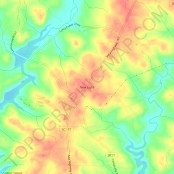
Name: New Light topographic map, elevation, terrain.

Location: New Light, Anderson County, South Carolina, United States (34.56927 -82.82292 34.60927 -82.78292)

Average elevation: 755 ft

Minimum elevation: 653 ft

Maximum elevation: 837 ft

Anderson County trails, hiking, mountain biking, running and outdoor activities

Other topographic maps

Click on a map to view its topography, its elevation and its terrain.

Belton

United States > South Carolina > Anderson County

Average elevation: 843 ft

Pendleton

United States > South Carolina > Anderson County

Average elevation: 787 ft

Iva

United States > South Carolina > Anderson County

Average elevation: 689 ft

Piedmont

United States > South Carolina > Anderson County

Average elevation: 843 ft

Piedmont

United States > South Carolina > Anderson County

Average elevation: 843 ft

Starr

United States > South Carolina > Anderson County

Average elevation: 745 ft

Piedmont

United States > South Carolina > Anderson County

Average elevation: 843 ft

Pendleton

United States > South Carolina > Anderson County

Average elevation: 787 ft

Pelzer

United States > South Carolina > Anderson County

Average elevation: 784 ft

Belton

United States > South Carolina > Anderson County

Average elevation: 843 ft

Gear up for your next adventure:

🧢Sun Protection Hats - Wide-brimmed and UPF-rated hats for high-altitude sun safety
🌐World Map Poster - Decorative world maps with topographic info
🖼️Topo Map Wall Art - Decorative topographic prints of famous peaks and regions
🌡️Portable Weather Meter - Track weather conditions on the trail
🚑Emergency Bivvies - Heat-reflective sleeping bags for survival situations

As an Amazon Associate, this site earns from qualifying purchases at no extra cost to you.