
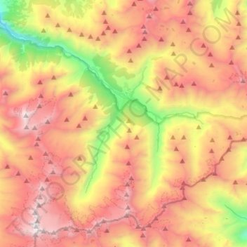
Cogne topographic map
Interactive map
Click on the map to display elevation.
About this map
Name: Cogne topographic map, elevation, terrain.
Location: Cogne, Aostatal, 11012, Italien (45.51260 7.25712 45.66706 7.50620)
Average elevation: 8,451 ft
Minimum elevation: 3,340 ft
Maximum elevation: 13,163 ft
Cogne ist eine italienische Gemeinde mit 1350 Einwohnern (Stand 31. Dezember 2019) im Cogne-Tal, einem Seitental der Region Aostatal. Die Gemeinde liegt auf einer Höhe von 1534 m s.l.m. und hat eine Fläche von 212 km².
Other topographic maps
Click on a map to view its topography, its elevation and its terrain.
Bruil (Capoluogo)
Bruil (Capoluogo), Chanavey, Rhêmes-Notre-Dame, Aostatal, Italien
Average elevation: 7,254 ft
Monte Emilius
Monte Emilius, Pollein, Aostatal, Italien
Average elevation: 9,567 ft
Monte Rosa Massiv
Italien > Aostatal > Gressoney-La-Trinité
Monte Rosa Massiv, Gressoney-La-Trinité, Aostatal, Italien
Average elevation: 11,411 ft
Dent d'Hérens
Dent d'Hérens, Bionaz, Aostatal, 11021, Italien
Average elevation: 11,004 ft
Monte Bianco di Courmayeur
Italien > Aostatal > Courmayeur
Monte Bianco di Courmayeur, Courmayeur, Aostatal, Italien
Average elevation: 12,999 ft
Maddalena
Italien > Aostatal > Pont-Saint-Martin > Maddalena
Maddalena, Pont-Saint-Martin, Aostatal, 11026, Italien
Average elevation: 2,175 ft
Torrent de la Borna
Italien > Aostatal > Fénis > Etsely
Torrent de la Borna, Etsely, Fénis, Aostatal, Italien
Average elevation: 8,235 ft
Testa d'Arpy
Testa d'Arpy, Morgex, Aostatal, 11017, Italien
Average elevation: 5,417 ft
Ermitage
Italien > Aostatal > Courmayeur > Ermitage
Ermitage, Courmayeur, Aostatal, 11013, Italien
Average elevation: 5,446 ft
Champorcher
Italien > Aostatal > Champorcher
Champorcher, Aostatal, Italien
Average elevation: 4,216 ft