
Berland topographic map
Interactive map
Click on the map to display elevation.
About this map
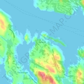
Name: Berland topographic map, elevation, terrain.
Location: Berland, Askøy, Vestland, 5314, Norvège (60.50493 5.03494 60.54493 5.07494)
Average elevation: 43 ft
Minimum elevation: -13 ft
Maximum elevation: 262 ft
Other topographic maps
Click on a map to view its topography, its elevation and its terrain.
Preikestolen
Preikestolen, Osterøy, Vestland, 5284, Norvège
Average elevation: 860 ft
Vossavangen
Norvège > Vestland > Vossavangen
Vossavangen, Voss herad, Vestland, 5701, Norvège
Average elevation: 1,155 ft