
Kalilangan topographic map
Click on the map to display elevation.
About this map
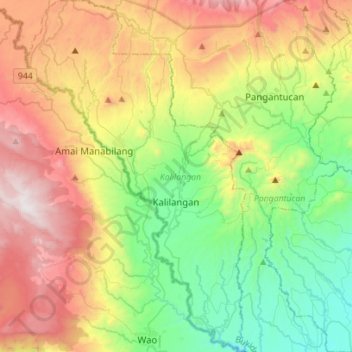
Name: Kalilangan topographic map, elevation, terrain.
Location: Kalilangan, Bukidnon, Northern Mindanao, Philippines (7.62839 124.62880 7.90578 124.80271)
Average elevation: 2,822 ft
Minimum elevation: 922 ft
Maximum elevation: 5,764 ft
Other topographic maps
Click on a map to view its topography, its elevation and its terrain.