
Phalombe topographic map
Interactive map
Click on the map to display elevation.
About this map
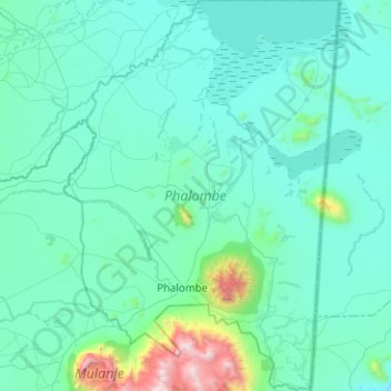
Name: Phalombe topographic map, elevation, terrain.
Location: Phalombe, Southern Region, Malawi, Malawi (-15.93394 35.49537 -15.45001 35.85104)
Average elevation: 2,559 ft
Minimum elevation: 1,900 ft
Maximum elevation: 8,930 ft
Other topographic maps
Click on a map to view its topography, its elevation and its terrain.
Capital Hill
Capital Hill, Lilongwe, Central Region, AREA 32, Malawi
Average elevation: 3,514 ft
Lake Chilwa
Lake Chilwa, Zomba, Southern Region, Malawi
Average elevation: 2,123 ft