Sicily topographic maps
Click on a map to view its topography, its elevation and its terrain.
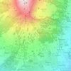
Mount Etna
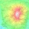
During the first 1500 years AD, many eruptions went unrecorded (or records have been lost); among the more significant are: (1) an eruption in about 1030 AD near Monte Ilice on the lower southeast flank, which produced a lava flow that travelled about 10 km, reaching the sea north of Acireale; the villages of…
Average elevation: 3,796 ft




Favara
The town is located on the slope of a 533 m hill, Monte Caltafaraci, locally known as the Muntaggneḍḍa (little mountain in Sicilian). The average elevation is 338 m, with a minimum of 20 m and a maximum of 533 m. Favara is part of the agricultural region #5 Agrigento seaside hills (Italian: Colline…
Average elevation: 833 ft



Chiaramonte Gulfi
Chiaramonte Gulfi is located on a hill-top 15 kilometres (9 mi) north of Ragusa at an altitude of 668 metres (2,192 ft) above sea level. The highest point is on Monte Arcibessi at 907 metres (2,976 ft). Its hamlets (frazioni) are the villages of Piano dell'Acqua, Roccazzo and Sperlinga.
Average elevation: 1,634 ft
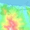
Randazzo
The geographical position of Randazzo also contributes to its climate. The town experiences a Mediterranean climate, characterized by hot, dry summers and mild, rainy winters. However, due to its proximity to Mount Etna, microclimates can be observed, with variations in temperature and precipitation depending…
Average elevation: 3,750 ft


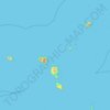
Aeolian Islands
The largest island is Lipari (37.5 km²), followed by Salina (26.8 km²), Vulcano (21.2 km²), Stromboli (12.6 km²), Filicudi (9.5 km²) and Alicudi (5.2 km²). The smallest island with 3.4 km² is Panarea. The highest elevation of the Lipari Islands is Monte Fossa delle Felci on Salina, which reaches a…
Average elevation: 13 ft
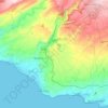




Motta Sant'Anastasia
The structure consists of three elevations. Only the first of these is still the original arched windows ogive (external) and at all sixth (inside). The other two square windows, on other levels, such as the current front door, go back to the 15th century.The ground floor was designed for military housing. In…
Average elevation: 341 ft


Marsala
The archaeological area of Marsala has been investigated both through excavations and topographic studies. Lilybaeum, the ancient town, took up a rectangular area on Capo Boeo, a low and rocky promontory sloping gently down towards the sea. The urban layout of the town can be dated back to the 2nd century BC…
Average elevation: 72 ft

Syracuse
Geologically, the Syracuse area is part of the Hyblaean Mountains. Its topography consists of moderate peaks, the most prominent being the plateau of Epipoli, part of the easternmost Hyblaean foothills. At the base of Epipoli, located between the districts of Acradina and Neapolis, rises the Temenite Hill. The…
Average elevation: 62 ft
Caltanissetta
Italy > Sicily > Caltanissetta
The expansive territory of Caltanissetta ranks as Italy's 14th largest comune by area and the fourth largest in Sicily, following Noto, Monreale, and Ragusa. Located in Sicily's interior, it has no coastline. The terrain, part of the Erean Mountains, is predominantly hilly, with its highest peak reaching 859…
Average elevation: 1,407 ft
Aragona
Aragona is located on the eastern slopes of the Mount Belvedere at an altitude of 428 m. In the 13th century, the Castello di Barrugeri was built near what is now Aragona, but it no longer exists. The town was founded on 6 January 1606, upon the initiative of lord Baldassare III Naselli, Count of Comiso. He…
Average elevation: 991 ft