
湖光镇 topographic map
Interactive map
Click on the map to display elevation.
About this map
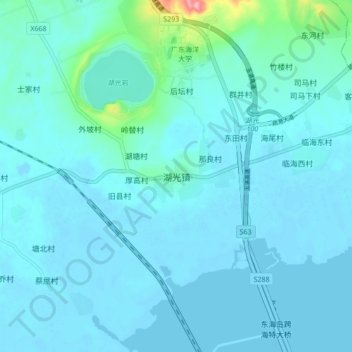
Name: 湖光镇 topographic map, elevation, terrain.
Location: 湖光镇, 湛江市, 广东省, 中国 (21.08477 110.25480 21.16477 110.33480)
Average elevation: 46 ft
Minimum elevation: -16 ft
Maximum elevation: 495 ft
Other topographic maps
Click on a map to view its topography, its elevation and its terrain.