
黄坡镇 topographic map
Interactive map
Click on the map to display elevation.
About this map
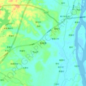
Name: 黄坡镇 topographic map, elevation, terrain.
Location: 黄坡镇, 湛江市, 广东省, 中国 (21.28243 110.54448 21.36243 110.62448)
Average elevation: 30 ft
Minimum elevation: -7 ft
Maximum elevation: 105 ft
Other topographic maps
Click on a map to view its topography, its elevation and its terrain.