
黄略镇 topographic map
Interactive map
Click on the map to display elevation.
About this map
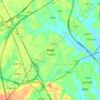
Name: 黄略镇 topographic map, elevation, terrain.
Location: 黄略镇, 湛江市, 广东省, 中国 (21.28671 110.28362 21.36671 110.36362)
Average elevation: 59 ft
Minimum elevation: -10 ft
Maximum elevation: 144 ft
Other topographic maps
Click on a map to view its topography, its elevation and its terrain.