
那毛村 topographic map
Interactive map
Click on the map to display elevation.
About this map
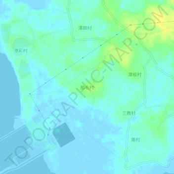
Name: 那毛村 topographic map, elevation, terrain.
Location: 那毛村, 湛江市, 广东省, 中国 (20.50212 109.81908 20.54212 109.85908)
Average elevation: 16 ft
Minimum elevation: -10 ft
Maximum elevation: 72 ft
Other topographic maps
Click on a map to view its topography, its elevation and its terrain.