
Nord-Fron topographic map
Interactive map
Click on the map to display elevation.
About this map
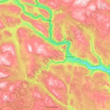
Name: Nord-Fron topographic map, elevation, terrain.
Location: Nord-Fron, Innlandet, Norvège (61.34089 8.89965 61.86631 10.01496)
Average elevation: 3,035 ft
Minimum elevation: 591 ft
Maximum elevation: 5,696 ft
Other topographic maps
Click on a map to view its topography, its elevation and its terrain.
Trollstigen
Trollstigen, Søndre Land, Innlandet, Norvège
Average elevation: 1,506 ft
Viewpoint Snøhetta
Viewpoint Snøhetta, Vålåsjøhøvegen, Dovre, Innlandet, 2661, Norvège
Average elevation: 3,796 ft