
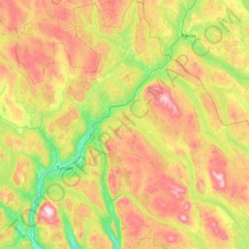
Tolga topographic map
Interactive map
Click on the map to display elevation.
About this map
Name: Tolga topographic map, elevation, terrain.
Location: Tolga, Innlandet, Norvège (62.14358 10.47382 62.60012 11.69582)
Average elevation: 2,822 ft
Minimum elevation: 1,407 ft
Maximum elevation: 5,413 ft
Other topographic maps
Click on a map to view its topography, its elevation and its terrain.
Trollstigen
Trollstigen, Søndre Land, Innlandet, Norvège
Average elevation: 1,506 ft
Viewpoint Snøhetta
Viewpoint Snøhetta, Vålåsjøhøvegen, Dovre, Innlandet, 2661, Norvège
Average elevation: 3,796 ft