
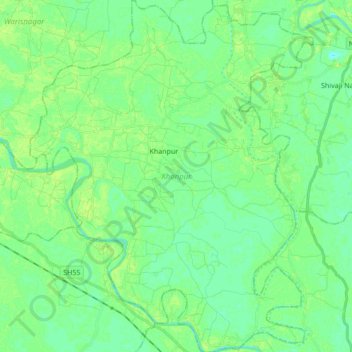
Khanpur topographic map
Interactive map
Click on the map to display elevation.
About this map
Name: Khanpur topographic map, elevation, terrain.
Location: Khanpur, Samastipur District, Bihar, India (25.77414 85.86984 25.92764 86.00716)
Average elevation: 151 ft
Minimum elevation: 131 ft
Maximum elevation: 171 ft
Other topographic maps
Click on a map to view its topography, its elevation and its terrain.
Patna
India > Bihar > Patna Rural
Patna, Patna Rural, Patna District, Bihar, 800001, India
Average elevation: 167 ft
Sultanganj
India > Bihar > Sultanganj
Sultanganj, Bhagalpur District, Bihar, 812006, India
Average elevation: 115 ft
Parmanandpur
Parmanandpur, Basantpur, Supaul, Bihar, India
Average elevation: 249 ft
Gaya
India > Bihar > Gaya Town C.D.Block
Gaya, Gaya Town C.D.Block, Gaya District, Bihar, 823001, India
Average elevation: 364 ft
Baruraj (Motipur)
India > Bihar > Baruraj (Motipur)
Baruraj (Motipur), Muzaffarpur, Bihar, 843132, India
Average elevation: 190 ft
Manikpur
India > Bihar > Narpatganj
Manikpur, Narpatganj, Araria, Bihar, 854336, India
Average elevation: 230 ft
Sonbhadra Banshi Suryapur
Sonbhadra Banshi Suryapur, Arwal, Bihar, India
Average elevation: 249 ft