
Gaston topographic map
Interactive map
Click on the map to display elevation.
About this map
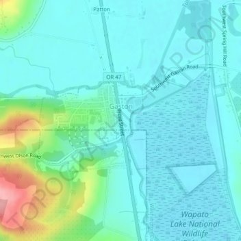
Name: Gaston topographic map, elevation, terrain.
Location: Gaston, Washington County, Oregon, United States (45.42976 -123.15601 45.43936 -123.13577)
Average elevation: 217 ft
Minimum elevation: 141 ft
Maximum elevation: 538 ft
Other topographic maps
Click on a map to view its topography, its elevation and its terrain.
Hillsboro
United States > Oregon > Washington County
Hillsboro, Washington County, Oregon, United States
Average elevation: 174 ft
Tigard
United States > Oregon > Washington County
Tigard, Washington County, Oregon, United States
Average elevation: 272 ft
Beaverton
United States > Oregon > Washington County
Beaverton, Washington County, Oregon, United States
Average elevation: 348 ft
Sherwood
United States > Oregon > Washington County
Sherwood, Washington County, Oregon, 97140, United States
Average elevation: 223 ft
South Hillsboro
United States > Oregon > Washington County > Hillsboro
South Hillsboro, Hillsboro, Washington County, Oregon, United States
Average elevation: 194 ft
Forest Grove
United States > Oregon > Washington County
Forest Grove, Washington County, Oregon, 97116, United States
Average elevation: 200 ft
Tualatin River
United States > Oregon > Washington County
Tualatin River, Washington County, Oregon, United States
Average elevation: 384 ft
North Plains
United States > Oregon > Washington County
North Plains, Washington County, Oregon, United States
Average elevation: 187 ft
Tualatin
United States > Oregon > Washington County
Tualatin, Washington County, Oregon, 97062, United States
Average elevation: 230 ft
Banks
United States > Oregon > Washington County
Banks, Washington County, Oregon, 97106, United States
Average elevation: 230 ft
Laurelwood
United States > Oregon > Washington County
Laurelwood, Washington County, Oregon, United States
Average elevation: 541 ft
L.L. Stub Stewart State Park
United States > Oregon > Washington County
L.L. Stub Stewart State Park, Service Road, Washington County, Oregon, 97109, United States
Average elevation: 981 ft
Rock Creek
United States > Oregon > Washington County
Rock Creek, Washington County, Oregon, United States
Average elevation: 213 ft
Chehalem
United States > Oregon > Washington County
Chehalem, Washington County, Oregon, 97140, United States
Average elevation: 594 ft
Vose
United States > Oregon > Washington County > Beaverton
Vose, Beaverton, Washington County, Oregon, United States
Average elevation: 230 ft
Denney Whitford/Raleigh West
United States > Oregon > Washington County > Beaverton
Denney Whitford/Raleigh West, Beaverton, Washington County, Oregon, United States
Average elevation: 236 ft
King City
United States > Oregon > Washington County
King City, Washington County, Oregon, United States
Average elevation: 243 ft
Cornelius
United States > Oregon > Washington County
Cornelius, Washington County, Oregon, United States
Average elevation: 164 ft
Timber
United States > Oregon > Washington County
Timber, Washington County, Oregon, 97144, United States
Average elevation: 1,047 ft
Pendelton Creek
United States > Oregon > Washington County > Portland
Pendelton Creek, Raleigh Hills, Portland, Washington County, Oregon, 97221, United States
Average elevation: 328 ft