
澄江市 topographic map
Interactive map
Click on the map to display elevation.
About this map
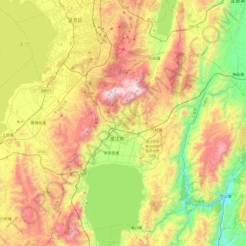
Name: 澄江市 topographic map, elevation, terrain.
Location: 澄江市, 玉溪市, 云南省, 652500, 中国 (24.48613 102.78525 24.92350 103.07549)
Average elevation: 6,342 ft
Minimum elevation: 4,239 ft
Maximum elevation: 9,177 ft
Other topographic maps
Click on a map to view its topography, its elevation and its terrain.