
富良棚乡 topographic map
Interactive map
Click on the map to display elevation.
About this map
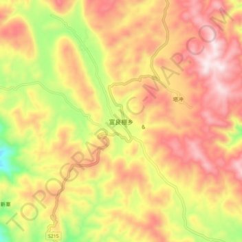
Name: 富良棚乡 topographic map, elevation, terrain.
Location: 富良棚乡, 玉溪市, 云南省, 中国 (24.27211 102.05032 24.35211 102.13032)
Average elevation: 6,588 ft
Minimum elevation: 5,384 ft
Maximum elevation: 7,490 ft
Other topographic maps
Click on a map to view its topography, its elevation and its terrain.