
江川区 topographic map
Interactive map
Click on the map to display elevation.
About this map
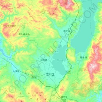
Name: 江川区 topographic map, elevation, terrain.
Location: 江川区, 玉溪市, 云南省, 中国 (24.20804 102.57565 24.52055 102.91816)
Average elevation: 6,352 ft
Minimum elevation: 5,472 ft
Maximum elevation: 8,658 ft
Other topographic maps
Click on a map to view its topography, its elevation and its terrain.