
研和街道 topographic map
Interactive map
Click on the map to display elevation.
About this map
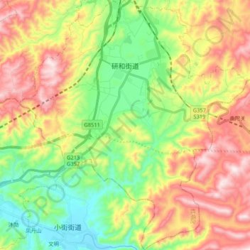
Name: 研和街道 topographic map, elevation, terrain.
Location: 研和街道, 红塔区, 玉溪市, 云南省, 中国 (24.14430 102.42952 24.29193 102.57729)
Average elevation: 5,860 ft
Minimum elevation: 4,990 ft
Maximum elevation: 7,014 ft
Other topographic maps
Click on a map to view its topography, its elevation and its terrain.