
通海县 topographic map
Interactive map
Click on the map to display elevation.
About this map
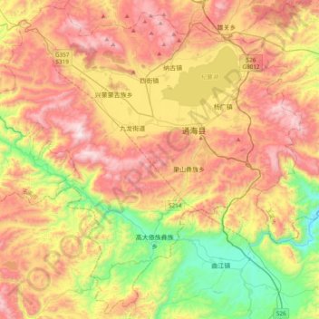
Name: 通海县 topographic map, elevation, terrain.
Location: 通海县, 玉溪市, 云南省, 中国 (23.91267 102.50754 24.24666 102.88718)
Average elevation: 5,978 ft
Minimum elevation: 4,114 ft
Maximum elevation: 7,940 ft
Other topographic maps
Click on a map to view its topography, its elevation and its terrain.