
雁石坪镇 topographic map
Interactive map
Click on the map to display elevation.
About this map
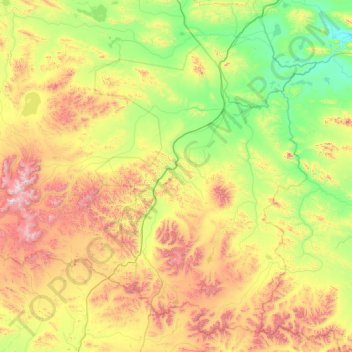
Name: 雁石坪镇 topographic map, elevation, terrain.
Location: 雁石坪镇, 安多县, 那曲市, 西藏自治区, 中国 (32.82185 91.10172 34.21776 93.22680)
Average elevation: 16,266 ft
Minimum elevation: 14,583 ft
Maximum elevation: 21,079 ft
Other topographic maps
Click on a map to view its topography, its elevation and its terrain.