
扎仁镇 topographic map
Interactive map
Click on the map to display elevation.
About this map
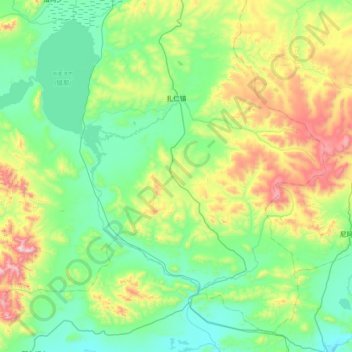
Name: 扎仁镇 topographic map, elevation, terrain.
Location: 扎仁镇, 安多县, 那曲市, 西藏自治区, 中国 (31.56953 91.28784 32.12331 92.01951)
Average elevation: 15,650 ft
Minimum elevation: 14,820 ft
Maximum elevation: 18,330 ft
Other topographic maps
Click on a map to view its topography, its elevation and its terrain.