
Bone Island topographic map
Click on the map to display elevation.
About this map
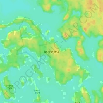
Name: Bone Island topographic map, elevation, terrain.
Average elevation: 600 ft
Minimum elevation: 561 ft
Maximum elevation: 656 ft
Other topographic maps
Click on a map to view its topography, its elevation and its terrain.
Stewart Lake
Canada > Ontario > Muskoka District > Georgian Bay Township > MacTier
Average elevation: 791 ft
South Branch Muskoka River;Spence Lake
Canada > Ontario > Muskoka District > Bracebridge
Average elevation: 902 ft
Georgian Bay Islands National Park
Canada > Ontario > Muskoka District > Georgian Bay Township
Average elevation: 597 ft
Limberlost Forest and Wildlife Reserve
Canada > Ontario > Muskoka District > Lake of Bays Township
Average elevation: 1,312 ft
Arrowhead Provincial Park
Canada > Ontario > Muskoka District > Huntsville
Average elevation: 1,096 ft