
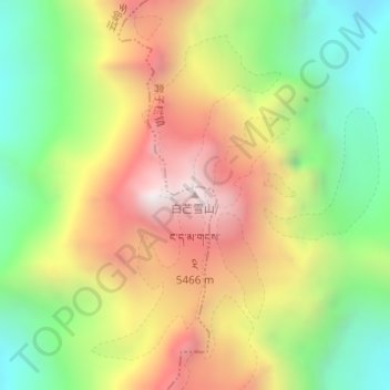
白马雪山 topographic map
Interactive map
Click on the map to display elevation.
About this map
Name: 白马雪山 topographic map, elevation, terrain.
Location: 白马雪山, 德钦县, 迪庆藏族自治州, 云南省, 中国 (28.30602 98.97552 28.30612 98.97562)
Average elevation: 15,623 ft
Minimum elevation: 13,812 ft
Maximum elevation: 17,690 ft
白马雪山也作白茫雪山、白芒雪山,位于中国云南省德钦县东南部,是澜沧江和金沙江及其支流支巴洛河的分水岭,是云岭西支北部的高大山地,擁有海拔超過5000m的山峰20座,主峰拉扎雀尼,海拔5429米(或5430m)。主要由三叠系砂页岩为主的地层构成,为典型的构造侵蚀山地。山顶终年积雪,冰川地貌发育。214国道穿过中部海拔4292米的白马雪山垭口。
Other topographic maps
Click on a map to view its topography, its elevation and its terrain.