
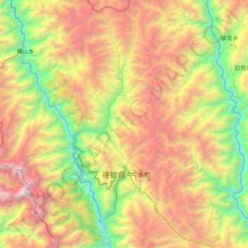
升平镇 topographic map
Interactive map
Click on the map to display elevation.
About this map
Name: 升平镇 topographic map, elevation, terrain.
Location: 升平镇, 德钦县, 迪庆藏族自治州, 云南省, 中国 (28.32380 98.80440 28.82496 99.06849)
Average elevation: 12,533 ft
Minimum elevation: 6,552 ft
Maximum elevation: 21,788 ft
Other topographic maps
Click on a map to view its topography, its elevation and its terrain.