
羊拉乡 topographic map
Interactive map
Click on the map to display elevation.
About this map
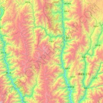
Name: 羊拉乡 topographic map, elevation, terrain.
Location: 羊拉乡, 德钦县, 迪庆藏族自治州, 云南省, 中国 (28.51231 98.91181 29.22572 99.16343)
Average elevation: 12,461 ft
Minimum elevation: 6,785 ft
Maximum elevation: 20,213 ft
“羊拉”为藏语“牛角箐”之意,“羊”为“牦牛”,“拉”为“角”,因地形得名。
Other topographic maps
Click on a map to view its topography, its elevation and its terrain.