
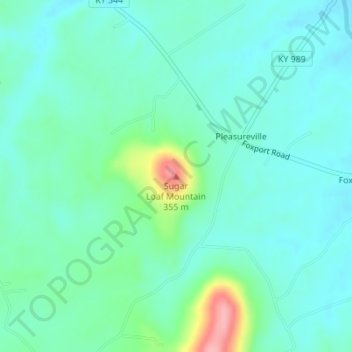
Sugar Loaf Mountain topographic map
Interactive map
Click on the map to display elevation.
About this map
Name: Sugar Loaf Mountain topographic map, elevation, terrain.
Location: Sugar Loaf Mountain, Fleming County, Kentucky, USA (38.47503 -83.60997 38.47513 -83.60987)
Average elevation: 850 ft
Minimum elevation: 768 ft
Maximum elevation: 1,155 ft
Other topographic maps
Click on a map to view its topography, its elevation and its terrain.
Brandenburg
USA > Kentucky > Brandenburg
Brandenburg, Meade County, Kentucky, USA
Average elevation: 551 ft
Spring Hill
USA > Kentucky > Spring Hill
Spring Hill, Hickman County, Kentucky, USA
Average elevation: 397 ft
Gardenside
USA > Kentucky > Gardenside
Gardenside, Fayette County, Kentucky, 40504, USA
Average elevation: 961 ft
Mount Morgan
Mount Morgan, Whitley County, Kentucky, 40769, USA
Average elevation: 1,227 ft
Little Georgetown
USA > Kentucky > Little Georgetown
Little Georgetown, Fayette County, Kentucky, 40513, USA
Average elevation: 935 ft
Mount Washington
USA > Kentucky > Mount Washington
Mount Washington, Bullitt County, Kentucky, 40047, USA
Average elevation: 604 ft
The Meadow
USA > Kentucky > The Meadow
The Meadow, Jefferson County, Kentucky, 40242, USA
Average elevation: 656 ft
Barren River
Barren River, Warren County, Kentucky, 42288, USA
Average elevation: 456 ft