
上末 topographic map
Interactive map
Click on the map to display elevation.
About this map
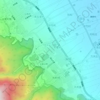
Name: 上末 topographic map, elevation, terrain.
Location: 上末, 大理市, 大理白族自治州, 云南省, 671000, 中国 (25.64167 100.15390 25.68167 100.19390)
Average elevation: 6,978 ft
Minimum elevation: 6,470 ft
Maximum elevation: 8,878 ft
Other topographic maps
Click on a map to view its topography, its elevation and its terrain.