
挖色镇 topographic map
Interactive map
Click on the map to display elevation.
About this map
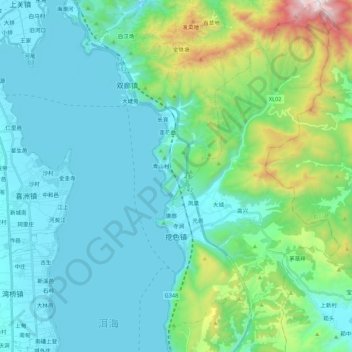
Name: 挖色镇 topographic map, elevation, terrain.
Location: 挖色镇, 大理市, 大理白族自治州, 云南省, 中国 (25.76632 100.20885 25.96184 100.32425)
Average elevation: 7,211 ft
Minimum elevation: 6,411 ft
Maximum elevation: 10,856 ft
Other topographic maps
Click on a map to view its topography, its elevation and its terrain.