
喜洲镇 topographic map
Interactive map
Click on the map to display elevation.
About this map
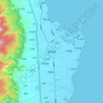
Name: 喜洲镇 topographic map, elevation, terrain.
Location: 喜洲镇, 大理市, 大理白族自治州, 云南省, 671004, 中国 (25.81364 100.09044 25.89364 100.17044)
Average elevation: 6,722 ft
Minimum elevation: 6,437 ft
Maximum elevation: 9,134 ft
Other topographic maps
Click on a map to view its topography, its elevation and its terrain.