
Thank you for supporting this site ❤️
Make a donation
Make a donation
Gear up for your next adventure:
As an Amazon Associate, this site earns from qualifying purchases at no extra cost to you.
庞各庄镇 topographic map
Click on the map to display elevation.
Thank you for supporting this site ❤️
Make a donation
Make a donation
Gear up for your next adventure:
As an Amazon Associate, this site earns from qualifying purchases at no extra cost to you.
About this map
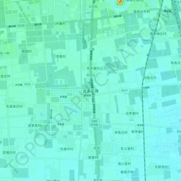
Name: 庞各庄镇 topographic map, elevation, terrain.
Location: 庞各庄镇, 大兴区, 北京市, 102609, 中国 (39.59406 116.27723 39.67406 116.35723)
Average elevation: 115 ft
Minimum elevation: 95 ft
Maximum elevation: 240 ft
Thank you for supporting this site ❤️
Make a donation
Make a donation
Gear up for your next adventure:
As an Amazon Associate, this site earns from qualifying purchases at no extra cost to you.
Other topographic maps
Click on a map to view its topography, its elevation and its terrain.