
雁山区 topographic map
Interactive map
Click on the map to display elevation.
About this map
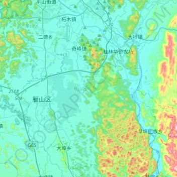
Name: 雁山区 topographic map, elevation, terrain.
Location: 雁山区, 桂林市, 广西壮族自治区, 541006, 中国 (24.99734 110.24664 25.23808 110.48782)
Average elevation: 702 ft
Minimum elevation: 400 ft
Maximum elevation: 2,346 ft
Other topographic maps
Click on a map to view its topography, its elevation and its terrain.