
平乐县 topographic map
Interactive map
Click on the map to display elevation.
About this map
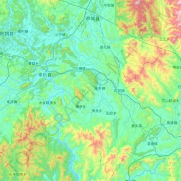
Name: 平乐县 topographic map, elevation, terrain.
Location: 平乐县, 桂林市, 广西壮族自治区, 中国 (24.26275 110.55452 24.89703 111.04508)
Average elevation: 1,280 ft
Minimum elevation: 236 ft
Maximum elevation: 5,902 ft
Other topographic maps
Click on a map to view its topography, its elevation and its terrain.