
高家山 topographic map
Interactive map
Click on the map to display elevation.
About this map
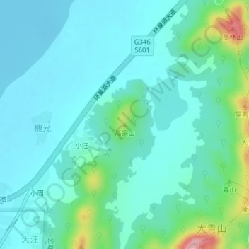
Name: 高家山 topographic map, elevation, terrain.
Location: 高家山, 合肥市, 安徽省, 中国 (31.44089 117.63615 31.44099 117.63625)
Average elevation: 128 ft
Minimum elevation: 16 ft
Maximum elevation: 620 ft
Other topographic maps
Click on a map to view its topography, its elevation and its terrain.