
杨家岭 topographic map
Interactive map
Click on the map to display elevation.
About this map
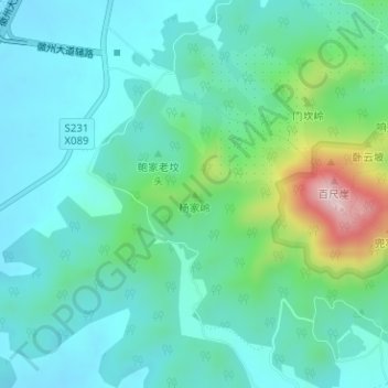
Name: 杨家岭 topographic map, elevation, terrain.
Location: 杨家岭, 合肥市, 安徽省, 中国 (31.30033 117.32385 31.30043 117.32395)
Average elevation: 344 ft
Minimum elevation: 108 ft
Maximum elevation: 1,194 ft
Other topographic maps
Click on a map to view its topography, its elevation and its terrain.