
Saltdal topographic map
Interactive map
Click on the map to display elevation.
About this map
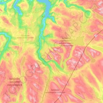
Name: Saltdal topographic map, elevation, terrain.
Location: Saltdal, Nordland, Norway (66.55786 14.96995 67.20484 16.30633)
Average elevation: 2,421 ft
Minimum elevation: 0 ft
Maximum elevation: 5,764 ft
Other topographic maps
Click on a map to view its topography, its elevation and its terrain.
Haukland Beach
Haukland Beach, Sjøbakken, Vestvågøy, Nordland, Norway
Average elevation: 338 ft
Ballangen - Bálák
Ballangen - Bálák, Narvik, Nordland, Norway
Average elevation: 299 ft
Sulitjelma - Sulisjielmmá
Sulitjelma - Sulisjielmmá, Fauske, Nordland, Norway
Average elevation: 1,243 ft