
Langfjorden topographic map
Interactive map
Click on the map to display elevation.
About this map
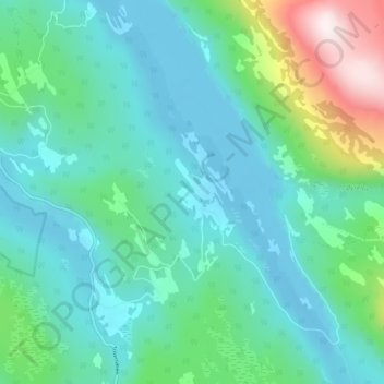
Name: Langfjorden topographic map, elevation, terrain.
Location: Langfjorden, Brønnøy, Nordland, Norway (65.35916 12.65570 65.39916 12.69570)
Average elevation: 522 ft
Minimum elevation: -30 ft
Maximum elevation: 2,598 ft
Other topographic maps
Click on a map to view its topography, its elevation and its terrain.
Haukland Beach
Haukland Beach, Sjøbakken, Vestvågøy, Nordland, Norway
Average elevation: 338 ft
Ballangen - Bálák
Ballangen - Bálák, Narvik, Nordland, Norway
Average elevation: 299 ft
Sulitjelma - Sulisjielmmá
Sulitjelma - Sulisjielmmá, Fauske, Nordland, Norway
Average elevation: 1,243 ft