
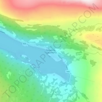
Sulitjelma - Sulisjielmmá topographic map
Interactive map
Click on the map to display elevation.
About this map
Name: Sulitjelma - Sulisjielmmá topographic map, elevation, terrain.
Location: Sulitjelma - Sulisjielmmá, Fauske, Nordland, Norway (67.11291 16.05738 67.15291 16.09738)
Average elevation: 1,243 ft
Minimum elevation: 420 ft
Maximum elevation: 3,058 ft
Other topographic maps
Click on a map to view its topography, its elevation and its terrain.
Haukland Beach
Haukland Beach, Sjøbakken, Vestvågøy, Nordland, Norway
Average elevation: 338 ft
Ballangen - Bálák
Ballangen - Bálák, Narvik, Nordland, Norway
Average elevation: 299 ft