

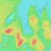
Iskut River topographic map
Click on the map to display elevation.
Iskut River
Near Bob Quinn Lake the Iskut is joined by one of its largest tributaries, the Ningunsaw River, flowing from the southeast. The Ningunsaw River's watershed covers an area of 673 km2 (260 sq mi). The landscape is very mountainous with elevations up to 2,183 m (7,162 ft). About 12% of the watershed is covered by glaciers. The lower Ningunsaw is braided and has good salmonid spawning habitats, although anadromous fish are currently unable to reach the Ningunsaw. The Ningunsaw River originates in Ningunsaw Provincial Park, and flows along the edge of Ningunsaw River Ecological Reserve, which is within the river's watershed. The historic Yukon Telegraph Trail passes through Ningunsaw Provincial Park and Ecological Reserve, then runs up the Iskut River to the vicinity of the Little Iskut River, where it leaves the Iskut, passes through the Little Iskut River watershed and through Mount Edziza Provincial Park to Telegraph Creek on the Stikine River. After the Ningunsaw confluence the Iskut River turns southwest, flowing through a braided channel and receiving the waters of Estshi Creek. The braided section comes to an end as Volcano Creek joins from the east, then Forrest Kerr Creek joins from the north.
About this map

Name: Iskut River topographic map, elevation, terrain.
Location: Iskut River, British Columbia, Canada (56.68034 -131.78927 57.83409 -129.97072)
Average elevation: 4,324 ft
Minimum elevation: 72 ft
Maximum elevation: 9,593 ft
Other topographic maps
Click on a map to view its topography, its elevation and its terrain.
Burnaby
Canada > British Columbia > Metro Vancouver Regional District > Burnaby
Burnaby occupies 98.60 square kilometres (38.07 sq mi) and is located at the geographic centre of the Metro Vancouver area and home to the Metro Vancouver regional government in Metrotown. Situated between the city of Vancouver on the west and Port Moody, Coquitlam, and New Westminster on the east, Burnaby is…
Average elevation: 472 ft
Whistler
Canada > British Columbia > Squamish-Lillooet Regional District > Whistler Resort Municipality > Whistler
Average elevation: 3,268 ft


Blue River
Canada > British Columbia > Thompson-Nicola Regional District > Area B (Thompson Headwaters)
Average elevation: 4,695 ft
Burnaby Mountain
Canada > British Columbia > Metro Vancouver Regional District > Burnaby
Due to its relatively high elevation, snow will often fall on the higher levels of Burnaby Mountain while rain falls in the surrounding cities. Tobogganing is a popular pastime at Centennial Park on winter days with snow.
Average elevation: 548 ft

Birken
Canada > British Columbia > Squamish-Lillooet Regional District > Area C (Pemberton Valley/Mount Currie/D'Arcy)
Average elevation: 2,612 ft
Anahim Lake
Canada > British Columbia > Cariboo Regional District > Area J (West Chilcotin)
Average elevation: 3,612 ft
White Rock
Canada > British Columbia > Metro Vancouver Regional District > White Rock > White Rock
Average elevation: 125 ft
Shawnigan Lake
Canada > British Columbia > Cowichan Valley Regional District > Area B (Shawnigan Lake)
Average elevation: 420 ft
Grouse Mountain
Canada > British Columbia > Metro Vancouver Regional District
Grouse Mountain is one of the North Shore Mountains of the Pacific Ranges in the District Municipality of North Vancouver, British Columbia, Canada. With a maximum elevation of over 1,200 m (4,100 feet) at its peak, the mountain is the site of an alpine ski area, Grouse Mountain Resort, which overlooks Greater…
Average elevation: 3,176 ft

Mill Bay
Canada > British Columbia > Cowichan Valley Regional District > Area A (Mill Bay / Malahat)
Average elevation: 200 ft

Kamloops
Canada > British Columbia > Thompson-Nicola Regional District > Kamloops
Average elevation: 2,871 ft

Monashee Mountains
Canada > British Columbia > Regional District of North Okanagan > Area F (Grindrod/Ashton Creek/Mabel Lake)
Average elevation: 5,528 ft
Cobble Hill
Canada > British Columbia > Cowichan Valley Regional District > Area C (Cobble Hill)
Average elevation: 381 ft
Fairmont Hot Springs
Canada > British Columbia > Regional District of East Kootenay > Area F (Columbia Lake/Windermere Lake)
Average elevation: 3,018 ft
Mission Creek Regional Park
Canada > British Columbia > Regional District of Central Okanagan > Kelowna
Average elevation: 1,430 ft
Grindrod
Canada > British Columbia > Regional District of North Okanagan > Area F (Grindrod/Ashton Creek/Mabel Lake)
Average elevation: 1,332 ft
Esquimalt
Canada > British Columbia > Capital Regional District > Esquimalt > Esquimalt
Average elevation: 46 ft

Okanagan Highland
Canada > British Columbia > Regional District of Okanagan-Similkameen > Area E (Naramata/Greyback)
Average elevation: 2,677 ft

Ta Ta Creek
Canada > British Columbia > Regional District of East Kootenay > Area E (Saint Mary/Skookumchuck)
Average elevation: 2,802 ft

Port Mellon
Canada > British Columbia > Sunshine Coast Regional District > Area F (West Howe Sound)
Average elevation: 591 ft


Sun Peaks
Canada > British Columbia > Thompson-Nicola Regional District > Sun Peaks Mountain Resort Municipality
Average elevation: 4,888 ft


Pavilion
The early anglicized version of the village name was Skwailuk, meaning hoar-frost, perhaps indicating the shaded ground remaining frozen during the long winters at this elevation. The Ts'kw'aylaxw First Nation (a.k.a. the Tsk'waylacw First Nation or Tsk'weylecw First Nation), residing on the Pavilion 1 Indian…
Average elevation: 2,805 ft





Hartley Bay
Canada > British Columbia > North Coast Regional District > Area C (South Skeena)
Average elevation: 266 ft



Bouchie Lake
Canada > British Columbia > Cariboo Regional District > Area B (Quesnel West/Bouchie Lake)
Average elevation: 2,293 ft
Errington
Canada > British Columbia > Regional District of Nanaimo > Area F (Alberni Highway)
Average elevation: 394 ft
Faulder
Canada > British Columbia > Regional District of Okanagan-Similkameen > Area F (Trout Creek Valley)
Average elevation: 2,789 ft
Walnut Park
Canada > British Columbia > Metro Vancouver Regional District > Surrey
Average elevation: 161 ft
Mount Douglas
Canada > British Columbia > Capital Regional District > Saanich
Average elevation: 154 ft
Fort Nelson
Canada > British Columbia > Northern Rockies Regional Municipality
Average elevation: 1,329 ft

Wasa Lake
Canada > British Columbia > Regional District of East Kootenay > Area E (Saint Mary/Skookumchuck) > Wasa
Average elevation: 2,602 ft
Langley Township
Canada > British Columbia > Metro Vancouver Regional District > Township of Langley > Langley Township
Average elevation: 121 ft
Falkland
Canada > British Columbia > Columbia-Shuswap Regional District > Area D (Falkland/Silver Creek)
Average elevation: 2,579 ft

Little Mountain
Canada > British Columbia > Metro Vancouver Regional District > Vancouver
Little Mountain, elevation 125 m (410 ft), is a mountain in the central part of the city of Vancouver, British Columbia, Canada. The mountain is home to Queen Elizabeth Park, which sits at the top of the mountain, and Nat Bailey Stadium, which is located near the base. The mountain lends its name to the Riley…
Average elevation: 266 ft
Hemlock Valley
Canada > British Columbia > Fraser Valley Regional District > Area C (Sasquatch Country)
Average elevation: 3,629 ft
Surrey
Canada > British Columbia > Metro Vancouver Regional District > Surrey
Average elevation: 213 ft
Saanich
Canada > British Columbia > Capital Regional District > Saanich > Saanich
Average elevation: 105 ft
Duncan Bay
Canada > British Columbia > Strathcona Regional District > Campbell River
Average elevation: 59 ft
Bell II
Canada > British Columbia > Regional District of Kitimat-Stikine > Area A (Nass Valley/Bell Irving) > Bell II
Average elevation: 2,208 ft

Hoodoo Mountain
Canada > British Columbia > Regional District of Kitimat-Stikine > Area D (Iskut/Big Raven)
Hoodoo Mountain, sometimes referred to as Hoodoo Volcano, is a potentially active stratovolcano in the Northern Interior of British Columbia, Canada. It is located 25 kilometres (16 miles) northeast of the Alaska–British Columbia border on the north side of the Iskut River opposite of the mouth of the Craig…
Average elevation: 5,436 ft
Mount Morrisey
Canada > British Columbia > Thompson-Nicola Regional District > Sun Peaks Mountain Resort Municipality
Average elevation: 4,974 ft

5040 Peak
Canada > British Columbia > Alberni-Clayoquot Regional District > Area D (Sproat Lake)
Average elevation: 3,583 ft
Cultus Lake
Canada > British Columbia > Fraser Valley Regional District > Area H (Cultus Lake/Columbia Valley) > Cultus Lake
Average elevation: 627 ft

Lang Bay
Canada > British Columbia > qathet Regional District > Area C (Lois Lake/Saltery Bay)
Average elevation: 220 ft
Spider Lake
Canada > British Columbia > Thompson-Nicola Regional District > Area O (Lower North Thompson)
Average elevation: 4,455 ft
Chute Lake
Canada > British Columbia > Regional District of Okanagan-Similkameen > Area E (Naramata/Greyback)
Average elevation: 4,177 ft

Wynndel
Canada > British Columbia > Regional District of Central Kootenay > Area A (Wynndel/Crawford Bay/Riondel)
Average elevation: 2,336 ft

Westwold
Canada > British Columbia > Thompson-Nicola Regional District > Area L (Grasslands)
Average elevation: 2,129 ft
Alexis Creek
Canada > British Columbia > Cariboo Regional District > Area K (East Chilcotin)
Average elevation: 2,671 ft
Yale
Canada > British Columbia > Fraser Valley Regional District > Area B (South Fraser Canyon/Sunshine Valley)
Average elevation: 1,115 ft
Goldstream River
Canada > British Columbia > Capital Regional District > Juan de Fuca Electoral Area
Average elevation: 810 ft
Bowser
Canada > British Columbia > Regional District of Nanaimo > Area H (Lighthouse Country)
Average elevation: 171 ft

Mount Waddington
Canada > British Columbia > Regional District of Mount Waddington > Area A (Seymour Inlet/Knight Inlet)
Average elevation: 10,374 ft

Mount McGrath
Canada > British Columbia > North Coast Regional District > Area C (South Skeena)
Average elevation: 1,293 ft

Swansea Point
Canada > British Columbia > Columbia-Shuswap Regional District > Area E (Eagle River Valley)
Average elevation: 1,854 ft

Boundary Creek
Canada > British Columbia > Regional District of Kootenay Boundary > Area E (Beaverdell/West Boundary)
Average elevation: 3,350 ft

Lulu Island
Canada > British Columbia > Metro Vancouver Regional District > Richmond
Average elevation: 52 ft

Macdonald Peak
Canada > British Columbia > Fraser Valley Regional District > Area E (Chilliwack River Valley)
Average elevation: 5,620 ft

Thorald Creek
Canada > British Columbia > Regional District of East Kootenay > Area F (Columbia Lake/Windermere Lake)
Average elevation: 6,243 ft

Burnt Peak
Canada > British Columbia > Metro Vancouver Regional District > West Vancouver
Average elevation: 1,165 ft
Woss
Canada > British Columbia > Regional District of Mount Waddington > Area D (Nimpkish Valley/Cormorant Island)
Average elevation: 656 ft
Oyster River
Canada > British Columbia > Strathcona Regional District > Area D (Oyster Bay/Buttle Lake) > Oyster River
Average elevation: 79 ft
Shuswap
Canada > British Columbia > Regional District of East Kootenay > Area F (Columbia Lake/Windermere Lake)
Average elevation: 3,038 ft
Gabriola
Canada > British Columbia > Regional District of Nanaimo > Area B (DeCourcy/Gabriola/Mudge)
Gabriola is about 14 kilometres (9 mi) long by 4.2 kilometres (2.6 mi) wide on average with a land area of 57.6 square kilometres (22.2 sq mi). The topography varies from flat sandy beaches at sea level to forested hills rising to 160 metres (525 ft) on Stoney Ridge in the centre of the island.
Average elevation: 102 ft
The Commons Field
Canada > British Columbia > Regional District of Central Okanagan > Kelowna
Average elevation: 1,450 ft
Woodlot 0007
Canada > British Columbia > Metro Vancouver Regional District > Maple Ridge
Average elevation: 1,056 ft
Agur Lake
Canada > British Columbia > Regional District of Okanagan-Similkameen > Area F (Trout Creek Valley)
Average elevation: 3,865 ft
Crooked River
Canada > British Columbia > Regional District of Fraser-Fort George > Area G (Crooked River/Parsnip)
Average elevation: 2,457 ft
Carp Lake
Canada > British Columbia > Regional District of Fraser-Fort George > Area G (Crooked River/Parsnip)
Average elevation: 2,838 ft