
Monte Lake topographic map
Click on the map to display elevation.
About this map
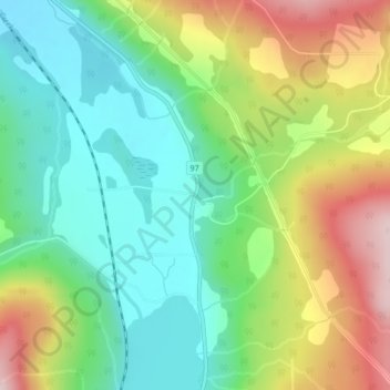
Name: Monte Lake topographic map, elevation, terrain.
Average elevation: 2,592 ft
Minimum elevation: 2,182 ft
Maximum elevation: 3,291 ft
Other topographic maps
Click on a map to view its topography, its elevation and its terrain.
Vancouver
Canada > British Columbia > Metro Vancouver Regional District
Vancouver, British Columbia, is situated on the Burrard Peninsula, bordered by Burrard Inlet to the north and the Fraser River to the south. The city's topography is a blend of flat and hilly terrains, with elevations ranging from sea level to approximately 152 meters (500 feet) above sea level. The North…
Average elevation: 112 ft
Victoria
Canada > British Columbia > Capital Regional District
Victoria, British Columbia, is situated on the southern tip of Vancouver Island, Canada, and boasts a diverse and varied topography. The city is characterized by rolling hills, rugged coastal cliffs, and lush valleys, providing a striking contrast between mountainous terrain and flatland areas. To the north…
Average elevation: 56 ft
Burnaby
Canada > British Columbia > Metro Vancouver Regional District
Burnaby occupies 98.6 square kilometres (38.1 sq mi) and is located at the geographic centre of the Metro Vancouver Regional District. The regional district's government is located in Burnaby's Metrotown area. Situated between the city of Vancouver on the west and Port Moody, Coquitlam, and New Westminster on…
Average elevation: 194 ft
Prince George
Canada > British Columbia > Regional District of Fraser-Fort George
The area has a humid continental climate (Köppen climate classification Dfb, Trewartha Dclo), but is close to (and once had) a subarctic climate (Dfc) as May and September averages are both close to the 10 °C (50 °F) threshold. Winters are milder than the latitude and elevation might suggest: the January…
Average elevation: 2,247 ft
Kelowna
Canada > British Columbia > Regional District of Central Okanagan
Kelowna is classified as a humid continental climate or an inland oceanic climate per the Köppen climate classification system due to its coldest month having an average temperature slightly above −3.0 °C (26.6 °F) and below 0 °C (32 °F), with dry, hot, sunny summers and cool, cloudy winters, and four…
Average elevation: 2,310 ft
Vancouver Island
The rain shadow effect of the island's mountains, as well as the mountains of Washington's Olympic Peninsula, creates wide variation in precipitation. The west coast is considerably wetter than the east coast. Average annual precipitation ranges from 6,650 mm (262 in) at Hucuktlis Lake on the west coast…
Average elevation: 1,348 ft
Coquitlam
Canada > British Columbia > Metro Vancouver Regional District
Like much of Metro Vancouver, Coquitlam has an oceanic climate (Köppen climate type Cfb), experiencing mild temperatures and high precipitation; warm, dry summers and cool, wet winters. However, compared to most other cities in the area, precipitation is especially heavy in Coquitlam due to its proximity to…
Average elevation: 623 ft
Township of Langley
Canada > British Columbia > Metro Vancouver Regional District
Average elevation: 154 ft
Tsawwassen
Canada > British Columbia > Metro Vancouver Regional District > Delta
Average elevation: 39 ft
Savary Island
Canada > British Columbia > qathet Regional District > Area A (Malaspina/Toba)
Average elevation: 10 ft
Shuswap Lake
Canada > British Columbia > Columbia-Shuswap Regional District > Area F (Scotch Creek/Seymour Arm)
Average elevation: 3,491 ft
West Vancouver
Canada > British Columbia > Metro Vancouver Regional District
Average elevation: 1,260 ft
Chetwynd
Canada > British Columbia > Peace River Regional District
Carved out of an ancient floodplain, the small terrace upon which Chetwynd is situated lies in the northern foothills of the Rocky Mountains. Once used as a grazing spot by nomadic Aboriginals, the terrace was farmed by settlers until it was developed into a town. Two types of soil—namely, the Widmark and…
Average elevation: 2,986 ft
Bute Inlet
Canada > British Columbia > Strathcona Regional District > Area B (Discovery Islands/Mainland Inlets)
The Bute Inlet route was later considered for the mainline of the Canadian Pacific Railway (CPR), which would have seen extensive blasting down the west shore of the inlet and a series of bridges to reach Vancouver Island near Campbell River via Seymour Narrows. This route was passed over in favour of the…
Average elevation: 3,022 ft
Vedder River
Canada > British Columbia > Fraser Valley Regional District > Chilliwack
Average elevation: 361 ft
Little Heffley Lake
Canada > British Columbia > Thompson-Nicola Regional District > Area P (Rivers and the Peaks)
Average elevation: 3,396 ft
Kootenay Lake
Canada > British Columbia > Regional District of Central Kootenay
Average elevation: 5,279 ft
Port Alberni
Canada > British Columbia > Alberni-Clayoquot Regional District
Average elevation: 272 ft
Mission
Canada > British Columbia > Fraser Valley Regional District
The western part of the district, the Stave Valley, is largely rural and forested but its watercourse is home to what was the largest hydroelectric project in British Columbia until the Bridge River Power Project opened in 1961. It was built by the British Columbia Electric Railway (BCER) to provide power to…
Average elevation: 1,132 ft
Saltspring Island
Canada > British Columbia > Capital Regional District > Salt Spring Island Electoral Area
Average elevation: 236 ft
Monashee Provincial Park
Canada > British Columbia > Regional District of North Okanagan > Area E (Cherryville/East Creighton)
Average elevation: 5,502 ft
Skaha Lake
Canada > British Columbia > Regional District of Okanagan-Similkameen > Area I (Skaha West/Kaleden/Apex) > Kaleden
Average elevation: 2,300 ft
Hernando Island
Canada > British Columbia > qathet Regional District > Area A (Malaspina/Toba)
Average elevation: 75 ft
Penticton
Canada > British Columbia > Regional District of Okanagan-Similkameen
Penticton is located at the geographical coordinates of 49°29′28″N 119°35′19″W / 49.49111°N 119.58861°W / 49.49111; -119.58861 (Penticton) and covers an area of 42.10 km2 (16.25 sq mi), with a maximum north–south distance of 7 km (4.3 mi) wide between the Okanagan Lake to the north…
Average elevation: 2,303 ft
Osoyoos
Canada > British Columbia > Regional District of Okanagan-Similkameen
Average elevation: 1,070 ft
Texada Island
Canada > British Columbia > qathet Regional District > Area D (Texada Island)
Average elevation: 272 ft
Saturna Island
Canada > British Columbia > Capital Regional District > Southern Gulf Islands Electoral Area
Average elevation: 112 ft
Stave Lake
Canada > British Columbia > Area F (McConnell Creek/Hatzic Prairie)
Average elevation: 1,890 ft
Arbutus-Ridge
Canada > British Columbia > Metro Vancouver Regional District > Vancouver
Average elevation: 197 ft
Aldergrove Regional Park
Canada > British Columbia > Metro Vancouver Regional District > Township of Langley
Average elevation: 210 ft
Brentwood
Canada > British Columbia > Metro Vancouver Regional District > Burnaby
Average elevation: 226 ft
Oyama Lake
Canada > British Columbia > Regional District of Central Okanagan > East Central Okanagan Electoral Area
Average elevation: 4,551 ft
Gwaii Haanas National Park Reserve and Haida Heritage Site
Canada > British Columbia > North Coast Regional District
Average elevation: 135 ft
Revelstoke
Canada > British Columbia > Columbia-Shuswap Regional District
A small ski resort featuring a single short lift has operated on Mount MacKenzie since the 1960s, and snowcat skiing was offered for higher altitudes. A strong movement pushed to expand the entire mountain into a single resort, and construction started in the early 2000s (decade).
Average elevation: 3,222 ft
Hornby Island
Canada > British Columbia > Comox Valley Regional District > Area A (Baynes Sound)
Average elevation: 89 ft
Pacific Rim National Park Reserve of Canada
Canada > British Columbia > Alberni-Clayoquot Regional District
Average elevation: 276 ft
Rossland
Canada > British Columbia > Regional District of Kootenay Boundary
Average elevation: 3,701 ft
Port Alice
Canada > British Columbia > Regional District of Mount Waddington
Average elevation: 948 ft
Pemberton
Canada > British Columbia > Squamish-Lillooet Regional District
The climate of Pemberton is very warm and dry in the summer and mild and wet in the winter. Pemberton is an ecologically complex and diverse zone which is referred to as the Coast-Interior Transition zone. Moving from west to east in the direction of the prevailing winds and taking into consideration the…
Average elevation: 3,297 ft
Charlie Lake
Canada > British Columbia > Peace River Regional District > Area B (Finlay Valley/Beatton Valley)
Average elevation: 2,497 ft
New Westminster
Canada > British Columbia > Metro Vancouver Regional District
Average elevation: 144 ft
Area E (Chilliwack River Valley)
Canada > British Columbia > Fraser Valley Regional District
Average elevation: 3,386 ft
Radium Hot Springs
Canada > British Columbia > Regional District of East Kootenay
Average elevation: 2,992 ft
Fort St. John
Canada > British Columbia > Peace River Regional District
Sitting at an elevation of 690 m (2,260 ft), Fort Saint John is situated within a low-lying valley near the eastern foothills of the Muskwa Ranges and Hart Ranges of the Northern Rockies. Prairies lie to the east and north, while to the west the Rocky Mountains form a rain shadow. The city is built on…
Average elevation: 2,218 ft
Princeton
Canada > British Columbia > Regional District of Okanagan-Similkameen
Average elevation: 2,329 ft
Valemount
Canada > British Columbia > Regional District of Fraser-Fort George
Average elevation: 2,608 ft
Garibaldi Provincial Park
Canada > British Columbia > Squamish-Lillooet Regional District
There are over 150 glaciers in the park, including the Garibaldi Névé and Mamquam icefields. The highest peak in Garibaldi Park is Wedge Mountain, at an elevation of 2,891 metres (9,485 ft). It also includes volcanic features such as an andesite tuya known as The Table, a cinder cone known as the Opal Cone,…
Average elevation: 4,324 ft
Gabriola Island
Canada > British Columbia > Regional District of Nanaimo > Area B (DeCourcy/Gabriola/Mudge)
Gabriola is about 14 kilometres (9 mi) long by 4.2 kilometres (2.6 mi) wide on average with a land area of 57.6 square kilometres (22.2 sq mi). The topography varies from flat sandy beaches at sea level to forested hills rising to 160 metres (525 ft) on Stoney Ridge in the centre of the island.
Average elevation: 85 ft
Kitsumkalum Lake
Canada > British Columbia > Regional District of Kitimat-Stikine > Area C (Butedale/Kitlope/Kitsumkalum) > Rosswood
Average elevation: 1,555 ft
Indian Arm
Canada > British Columbia > Metro Vancouver Regional District > Electoral Area A
Average elevation: 1,519 ft
Burrard Inlet
Canada > British Columbia > Metro Vancouver Regional District > Anmore
Average elevation: 1,568 ft
Niskonlith Lake
Canada > British Columbia > Thompson-Nicola Regional District > Area P (Rivers and the Peaks)
Average elevation: 1,972 ft
West Kelowna
Canada > British Columbia > Regional District of Central Okanagan
Average elevation: 2,129 ft