
扶风县 topographic map
Interactive map
Click on the map to display elevation.
About this map
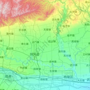
Name: 扶风县 topographic map, elevation, terrain.
Location: 扶风县, 宝鸡市, 陕西省, 中国 (34.21270 107.75069 34.62626 108.04982)
Average elevation: 2,283 ft
Minimum elevation: 1,388 ft
Maximum elevation: 5,420 ft
Other topographic maps
Click on a map to view its topography, its elevation and its terrain.