
凤翔区 topographic map
Interactive map
Click on the map to display elevation.
About this map
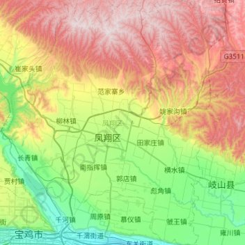
Name: 凤翔区 topographic map, elevation, terrain.
Location: 凤翔区, 宝鸡市, 陕西省, 中国 (34.34567 107.17629 34.74745 107.64074)
Average elevation: 3,166 ft
Minimum elevation: 1,742 ft
Maximum elevation: 5,413 ft
Other topographic maps
Click on a map to view its topography, its elevation and its terrain.