
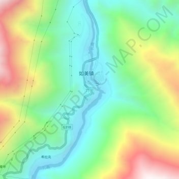
竹卡 topographic map
Interactive map
Click on the map to display elevation.
About this map
Name: 竹卡 topographic map, elevation, terrain.
Location: 竹卡, 昌都市, 西藏自治区, 中国 (29.59593 98.33164 29.63593 98.37164)
Average elevation: 10,105 ft
Minimum elevation: 8,530 ft
Maximum elevation: 13,018 ft
Other topographic maps
Click on a map to view its topography, its elevation and its terrain.