

Velebit topographic map
Click on the map to display elevation.
Velebit
Since records began in 1954, the highest temperature recorded at the Zavižan weather station at an elevation of 1,594 metres (5,230 ft) was 28.3 °C (82.9 °F), on 22 July 2015. The coldest temperature was −28.6 °C (−19.5 °F), on 10 February 1956.
About this map

Name: Velebit topographic map, elevation, terrain.
Location: Velebit, Croatia (44.20558 14.96433 44.97851 16.04141)
Average elevation: 1,798 ft
Minimum elevation: -13 ft
Maximum elevation: 5,699 ft
Other topographic maps
Click on a map to view its topography, its elevation and its terrain.

Zagreb
Zagreb (/ˈzɑːɡrɛb, ˈzæɡrɛb, zɑːˈɡrɛb/ ZAH-greb, ZAG-reb, zah-GREB, Croatian: [zǎːɡreb] (listen)) is the capital and largest city of Croatia. It is in the northwest of the country, along the Sava river, at the southern slopes of the Medvednica mountain. Zagreb stands near the international…
Average elevation: 817 ft

Hvar
Croatia > Split-Dalmatia County
The island has a typical Mediterranean vegetation, mostly bare with woody scrub at higher, steeper elevations, turning to pine forests on the lower slopes with Holm oak (Orno-Quercetum ilicis), Aleppo pines (Pinus halapensis Mill) and Black pines (Pinus nigra dalmatica). The islet of Šćedro is especially…
Average elevation: 190 ft

Dugi Otok
Dugi Otok (pronounced [dûɡiː ǒtok]; Croatian for "long Island", Italian: Isola Lunga) is part of Croatia and the seventh largest island in the Adriatic Sea. It is located off the Dalmatian coast, west of Zadar. It is the largest and westernmost of the Zadarian Islands, and derives its name from its…
Average elevation: 36 ft
Krk
Croatia > Primorje-Gorski Kotar County
A Eurasian griffon vulture colony lives in protected in an area called Kuntrep on Krk., There they breed at low elevations, with some nests at 10 m (33 ft). Therefore, contact with people is common.
Average elevation: 312 ft


Grad Sisak
Croatia > Sisak-Moslavina County
Sisak (pronounced [sǐːsak]; also known by other alternative names) is a city in central Croatia, spanning the confluence of the Kupa, Sava and Odra rivers, 57 km (35 mi) southeast of the Croatian capital Zagreb, and is usually considered to be where the Posavina (Sava basin) begins, with an elevation of 99…
Average elevation: 433 ft


Slavonski Brod
Croatia > Brod-Posavina County
The city is located 197 kilometres (122 miles) southeast of Zagreb and at an elevation of 96 metres (315 feet). It developed at the strategically important crossing over the Sava river toward Brod in Bosnia and Herzegovina. The Bosnian city was called Bosanski Brod until 2009.
Average elevation: 344 ft


Grad Trilj
Croatia > Split-Dalmatia County
Fort Čačvina is a fortification that guarded approach from Bosnia during the wars with the Ottomans. It is situated 8 kilometres (5 mi) from the town at an altitude of 705 metres (2,313 ft) in a strategic location enabling its crew to oversee traffic of goods through the mountain passage that goes through…
Average elevation: 1,749 ft




Makarska
Croatia > Split-Dalmatia County
Since records began in 1981, the highest temperature recorded at the local weather station at an elevation of 50 metres (160 ft) was 39.7 °C (103.5 °F), on 9 August 2017. The coldest temperature was −5.5 °C (22.1 °F), on 7 January 2017.
Average elevation: 1,581 ft




Grad Knin
Since records began in 1949, the highest temperature recorded at the local weather station at an elevation of 255 metres (837 ft) was 42.3 °C (108.1 °F), on 10 August 2017. The coldest temperature was −18.4 °C (−1.1 °F), on 17 February 1956.
Average elevation: 1,854 ft



Kneževi Vinogradi
Croatia > Osijek-Baranja County
Kneževi Vinogradi (Hungarian: Hercegszöllős; Serbian Cyrillic: Кнежеви Виногради) is a village and municipality in Croatia. It is situated in the Osijek-Baranja County, on the southern slopes of Bansko Brdo, 11 km southeast of Beli Manastir. It lies at an altitude of 103 m. Chief occupations…
Average elevation: 312 ft


Oštarije
Two weather stations exist there: one at an elevation of 318 metres (1,043 ft) in the train station, and one at an elevation of 329 metres (1,079 ft) at Ravnice. The minimum recorded temperature for the winter of 2024–2025 was −11.7 °C (10.9 °F) at the train station, on February 20, and −13.8 °C (7.2…
Average elevation: 1,096 ft

Susak
Croatia > Primorje-Gorski Kotar County > Susak
Located in the Kvarner Bay and southeast of the Istrian peninsula, the Croatian island of Susak is 7.4 kilometers (4.6 mi; 4.0 nmi) southwest from the island of Lošinj, 10 kilometers (6.2 mi; 5.4 nmi) south of the island of Unije, and 120 kilometers (75 mi; 65 nmi) east of the Italian coast. Susak is about 3…
Average elevation: 43 ft
Plitvice Lakes National Park
The afforested mountain slopes serve as water reservoirs. They are also a refuge for many animal species. The large difference in altitude in a narrow space between the mountains in the south and the Korana river in the north also represents a significant criterion for biodiversity in this region. The overall…
Average elevation: 2,510 ft

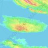


Mali Lošinj
Croatia > Primorje-Gorski Kotar County
Since records began in 1961, the highest temperature recorded at the local weather station at an elevation of 53 metres (174 ft) was 39.0 °C (102.2 °F), on 6 August 2017. From 1981 to 2011, the highest temperature recorded at the Čikat weather station was 36.6 °C (97.9 °F), on 2 August 1998. The coldest…
Average elevation: 30 ft





City of Varaždin
Since records began in 1949, the highest temperature recorded at the local weather station at an elevation of 157 metres (515 ft) was 39.4 °C (102.9 °F), on 8 August 2013. The coldest temperature was −28.0 °C (−18.4 °F), on 16 February 1956.
Average elevation: 564 ft


Vrbovsko
Croatia > Primorje-Gorski Kotar County
In the north, river Kupa separates Vrbovsko from adjoining Slovenia, while the eastern border follows the line of Zdihovo, Liplje and Bosiljevo settlements and cuts through the river Dobra valley near Ljubošina. The western border starts at the Kupa gorge at Radočaj, goes around Razdrto and passes over the…
Average elevation: 1,703 ft


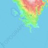


City of Zagreb
Zagreb (/ˈzɑːɡrɛb, ˈzæɡrɛb, zɑːˈɡrɛb/ ZAH-greb, ZAG-reb, zah-GREB, Croatian: [zǎːɡreb] (listen)) is the capital and largest city of Croatia. It is in the northwest of the country, along the Sava river, at the southern slopes of the Medvednica mountain. Zagreb stands near the international…
Average elevation: 597 ft



Plitvice Lakes National Park
The area of Plitvice Lakes National Park extends across two political subdivisions or counties (Croatian županija). Its 296.85 km2 (114.61 sq mi) area is divided between Lika-Senj County (90.7 percent) and Karlovac County (9.3 percent), hence the national park authority is under national jurisdiction. The…
Average elevation: 2,510 ft