
峡江县 topographic map
Interactive map
Click on the map to display elevation.
About this map
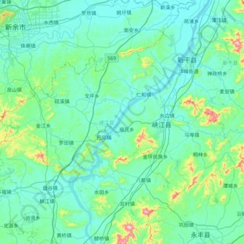
Name: 峡江县 topographic map, elevation, terrain.
Location: 峡江县, 吉安市, 江西省, 中国 (27.41571 114.87253 27.76436 115.53838)
Average elevation: 341 ft
Minimum elevation: 75 ft
Maximum elevation: 2,444 ft
Other topographic maps
Click on a map to view its topography, its elevation and its terrain.