
万安县 topographic map
Interactive map
Click on the map to display elevation.
About this map
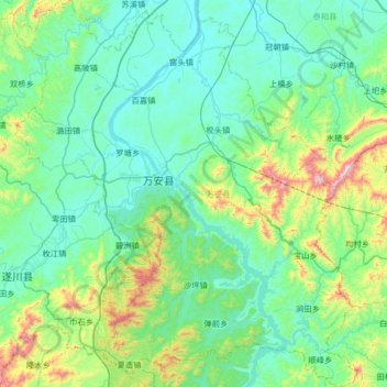
Name: 万安县 topographic map, elevation, terrain.
Location: 万安县, 吉安市, 江西省, 中国 (26.14589 114.50864 26.73439 115.09458)
Average elevation: 768 ft
Minimum elevation: 167 ft
Maximum elevation: 3,760 ft
Other topographic maps
Click on a map to view its topography, its elevation and its terrain.