
双凤桥街道 topographic map
Interactive map
Click on the map to display elevation.
About this map
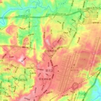
Name: 双凤桥街道 topographic map, elevation, terrain.
Location: 双凤桥街道, 渝北区, 重庆市主城都市区, 重庆市, 401120, 中国 (29.69724 106.58829 29.77724 106.66829)
Average elevation: 1,184 ft
Minimum elevation: 659 ft
Maximum elevation: 1,627 ft
Other topographic maps
Click on a map to view its topography, its elevation and its terrain.