
龙塔街道 topographic map
Interactive map
Click on the map to display elevation.
About this map
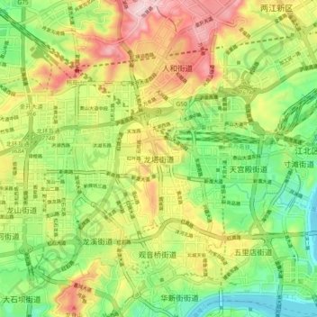
Name: 龙塔街道 topographic map, elevation, terrain.
Location: 龙塔街道, 渝北区, 重庆市, 400021, 中国 (29.56692 106.48823 29.64692 106.56823)
Average elevation: 951 ft
Minimum elevation: 512 ft
Maximum elevation: 1,529 ft
Other topographic maps
Click on a map to view its topography, its elevation and its terrain.