
龙兴镇 topographic map
Interactive map
Click on the map to display elevation.
About this map
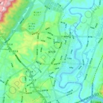
Name: 龙兴镇 topographic map, elevation, terrain.
Location: 龙兴镇, 渝北区, 重庆市, 中国 (29.66199 106.75110 29.74199 106.83110)
Average elevation: 843 ft
Minimum elevation: 531 ft
Maximum elevation: 1,998 ft
Other topographic maps
Click on a map to view its topography, its elevation and its terrain.