
Kullorsuaq Island topographic map
Interactive map
Click on the map to display elevation.
About this map
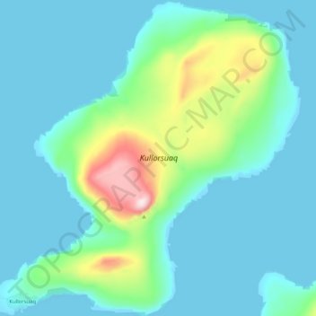
Name: Kullorsuaq Island topographic map, elevation, terrain.
Location: Kullorsuaq Island, Avannaata, Greenland (74.57665 -57.24386 74.63050 -57.03980)
Average elevation: 233 ft
Minimum elevation: -3 ft
Maximum elevation: 1,467 ft
Other topographic maps
Click on a map to view its topography, its elevation and its terrain.
Qeqertarsuaq
Qeqertarsuaq, Qeqertalik, 3953, Greenland
Average elevation: 312 ft
Jakobshavn Glacier
Jakobshavn Glacier, Avannaata, Greenland
Average elevation: 1,483 ft
Upernivik Island
Upernivik Island, Avannaata, Greenland
Average elevation: 1,969 ft
Ittoqqortoormiit
Ittoqqortoormiit, Sermersooq, 3980, Greenland
Average elevation: 262 ft
Qasigiannguit
Qasigiannguit, Qeqertalik, 3951, Greenland
Average elevation: 253 ft