
嘎洒街道 topographic map
Interactive map
Click on the map to display elevation.
About this map
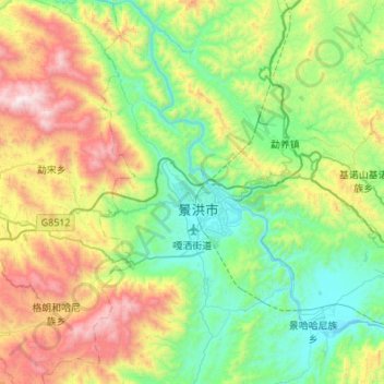
Name: 嘎洒街道 topographic map, elevation, terrain.
Location: 嘎洒街道, 景洪市, 西双版纳傣族自治州, 云南省, 666100, 中国 (21.77290 100.63111 22.27486 100.88380)
Average elevation: 3,488 ft
Minimum elevation: 1,693 ft
Maximum elevation: 7,831 ft
Other topographic maps
Click on a map to view its topography, its elevation and its terrain.